If you have ever tracked a commercial airline flight on FlightAware, Flightradar24, or a similar service, you likely noticed that pilots do not navigate in a straight line from airport to airport. Since the sky lacks roads and bridges to follow, why do they not fly straight toward the destination? Because the sky is full of invisible navigational fix points, and a collection of those navigational fixes makes up a defined flight plan route filed with and approved by air traffic control for the pilot to navigate from takeoff to landing.
NAVAIDs
So, what is a navigational fix? Referenced as NAVAIDs in aviation publications, a navigational fix is a waypoint that can be navigated to, from, or between airports or other navigational fixes. Navigational fixes can be GPS-based coordinates and ground-based navigational aids like VORs or airports, which have a defined airport reference point with set coordinates. A set series of navigational fixes are often compiled for departure and arrival procedures, known as SIDs and STARs. We will look at each in more detail.
VORs
A Very High-Frequency (VHF) Omni Directional Range Radio, or VOR for short, is a radio-based navigational aid operating from a ground station. The station emits 360-degree radials from the station. Equipment onboard aircraft receive this information and can identify which radial the plane is presently on, either navigating to or from that station. Many VOR stations are coupled with Distance Measuring Equipment (DME), which allows the aircraft to interpret how far it is from the station, in addition to knowing the aircraft’s position relevant to the station.
VOR stations are identified on aeronautical maps and flight plans by a 3-letter identifier. For example, the VOR station located on the airfield in Atlanta’s Hartsfield-Jackson International airport is identified as ATL. VORs have been around since the 1940s and remain an essential part of the navigational system, though their use is becoming less due to the prevalence of satellite-based GPS fixes.
GPS
Global Positioning System, or GPS, is the most common form of navigation in aviation today, both in general and commercial aviation. Thirty-one is very precise and reliable, and the information derived from GPS navigation helps reduce pilot workload. 31 satellites orbit the earth, each continuously emitting signals received by GPS receiver equipment onboard aircraft. If the receiver equipment receives signals from at least four satellites, the receiver can determine the position.
The more satellites the receiver has information from, the more precise the location and corresponding information, such as speed traveled and distance and time to the next fix. The receiver uses the time difference between the time of signal reception and the broadcast time to compute the distance, or range, from the receiver to the satellite.
GPS navigation can be used to determine an aircraft’s position, and just like VORs, GPS can also be used for a specific fix or NAVAID, a predetermined point to navigate to or from. GPS fixes are named and identified with a five-letter name. The FAA maintains a database of GPS fixes that currently totals 66,902! As we will see in the next section, some of the fix names are quite creative.
SIDs and STARs
Take a series of fixes, radio or satellite-based, and combine them into a charted procedure for departures and arrivals, and you have SIDs – a Standard Instrument Departure and STARs – Standard Terminal Arrival Route. Commercial flights typically begin with a SID and, in the final approach to the airport, a STAR. These procedures help flow large traffic volumes safely and minimize congestion on the radios pilots and air traffic controllers use to communicate.
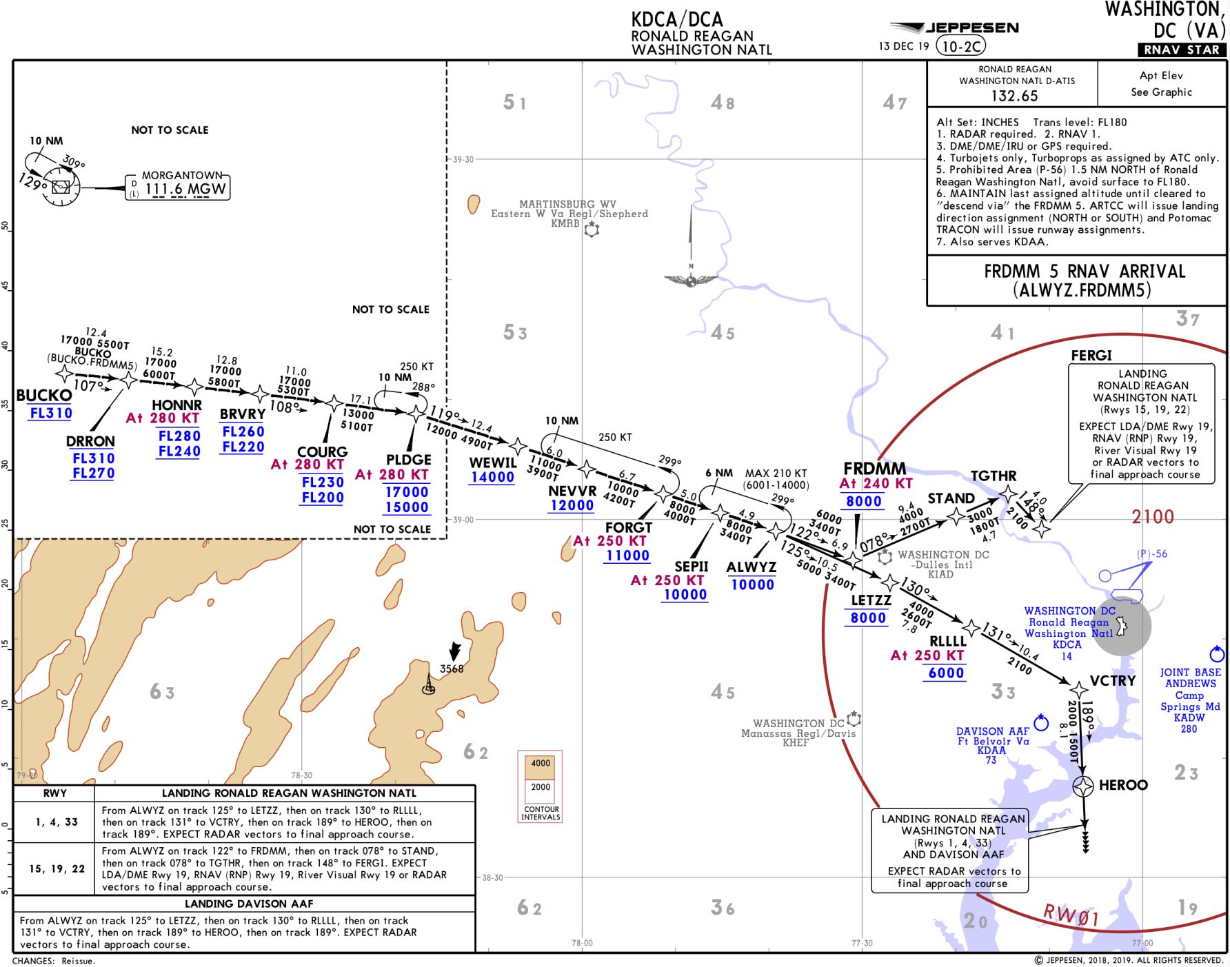
SIDs and STARs often have a local flavor, borrowing names from local sports teams or other attractions or history the area is known for. For example, pilots departing Cincinnati's CVG might be assigned the BNGLE 4 SID with the BNGLE fix a transition point – a homage to Cincinnati’s NFL team, the Bengals. My favorite is descending via the FRDMM 5 Arrival into Reagan National in Washington, DC. As we descend out of the cruise phase and into the Washington area, we navigate over HONNR, BRVRY, COURG, PLDGE, WEWILL, NEVVR, FORGT, SEPII – a heartwarming tribute to the darkest day in aviation.


